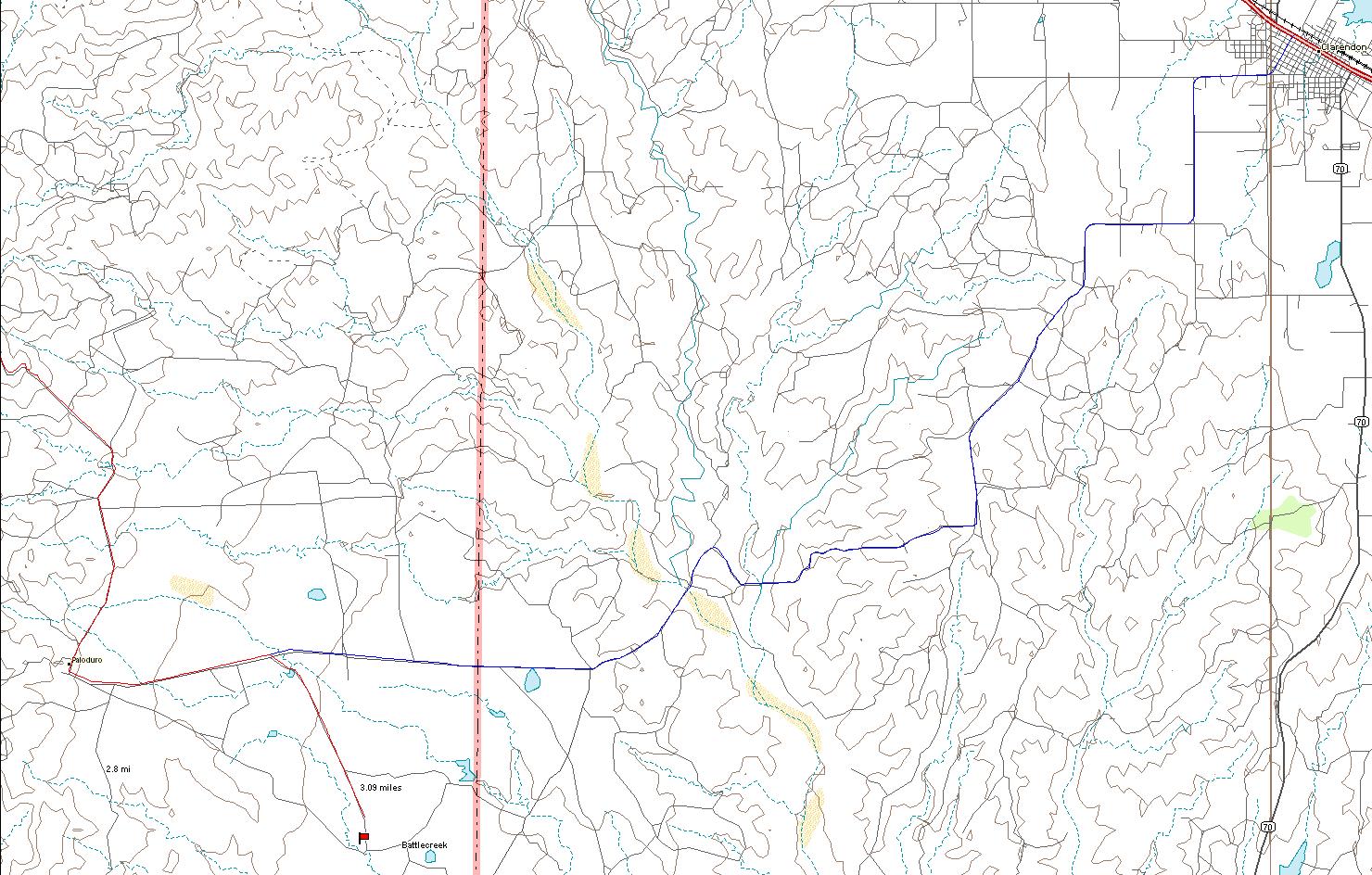
Clarendon to JA
Battlecreek In Clarendon, there is a stoplight downtown and then a
second one to the west where you can turn south, but not north. You
turn south between two convenience stores on Koogle Street. Koogle
Street becomes FM 2162. After 9.3 miles, the pavement ends at
a cattleguard and a very sharp right turn onto a dirt road Co Rd X.
Keep following the dirt road mainly southwest and then
west. You will go over two bridges and then west 10 miles and turn south
on a dirt road. The road to the south is after six
cattleguards and a small dip. Go 2 miles south to the pens.
Halls Creek Pens
In Clarendon, there is a stoplight downtown and then a second one
to the west where you can turn south, but not north. You turn south
between two convenience stores on Koogle Street. Koogle Street
becomes FM 2162. After 9.3 miles, the pavement ends at a
cattleguard and a very sharp right turn onto a dirt road Co Rd X.
Keep following the dirt road mainly southwest and then
west until you cross a bridge (3 1/3 miles).
In 1.5 miles before you cross the second bridge a road turns to the
south. Turn on it for ¼ of a mile.
Headquarters:
In Clarendon, there is a stoplight downtown and then a second one to the
west where you can turn south, but not north. You turn south between
two convenience stores on the south side of 287 on Koogle Street.
Koogle Street becomes FM 2162. After 9.3 miles, the pavement
ends at a cattleguard and a very sharp right turn onto a dirt road Co Rd X.
Keep following the dirt road
mainly southwest and then west. You will go over two bridges and then west
a total of 12.7 miles from Pavement to Headquarters.
Before headquarters, there are seven cattleguards. It
is On most maps, it shows as Paloduro.
The red line goes to Claude (see map).
Click on brand to return to
![]()
|
Click on brand to link to another ranch's information. |
||||
 |
 |
 |
|
|